Thorong Peak Climbing

Last Updated on October 1, 2022 by Alpha Adventure Treks

Rating: 5 out of 5.

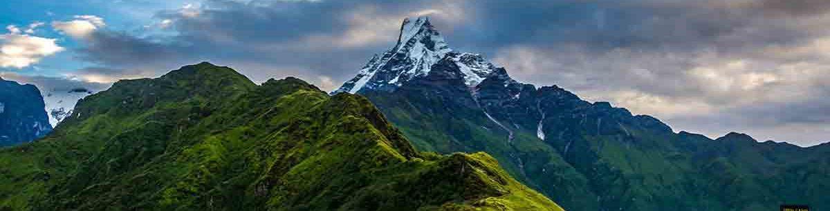
Mount Thorong (6,144 meters) Climbing is one of the most well-liked and fruitful adventure programs available. The Annapurna area hosts the straightforward-to-climb Thorong peak. It’s not true to claim that you require prior mountain climbing experience in order to climb Thorong Peak. For this exciting journey, you must be emotionally and physically prepared. You must be physically fit enough to climb Thorong Peak and be driven by a desire to experience some of the most breathtaking mountain views in Nepal’s Annapurna region. Along with reaching 6144 meters, you will gain first-hand knowledge of the beautiful Gurung people that live in this isolated area. They have a distinctive architectural style, live in remote settlements, practice Buddhism, and hold fervent spiritual convictions. The route will lead you past rhododendron forests that stand out sharply from the surrounding foliage with their red, white, and pink blossoms. The national flower of Nepal is the rhododendron. The location of Thorong Peak lies south of Thorong La Pass (5146m).

Your excursion starts at Bhulbhule (840m), then gradually climbs through a number of towns until you reach Thorong La Pass and Thorong Peak. At the foot of the Thorong La Pass in the Mustang District, in the holy Vishnu Muktinath Temple, which is revered by both Buddhists and Hindus, you will pay a visit. One of the tallest temples in the world, Muktinath is renowned for its 108 water fountains that are shaped like bulls. Before ending in Pokhara, the trip traverses the Kali Gandaki River Valley, passing through the towns of Jomsom (2743 meters above sea level, on the banks of the river), Marpha (1630 meters), Tukuche, and Tatopani.

Thorong Peak Climbing: Fitness and Experience

We advise engaging in physical activities like running, swimming, and some minor climbs to lower peaks that include climbs requiring the use of crampons for your own safety and success. Be competent of carrying about 30lbs/15 kg and be prepared for intense exposure and sharp drop-offs. Get some training in technical rock and mountaineering climbing if you can to get ready for your trek and ascent of Island Peak. Know how to use various climbing tools like ropes, crampons, and jumar ascenders.

Thorong Peak Climbing: Best Season

From March through May and from October through November, you can go Thorong Peak Climbing. The two seasons represented by these months are spring and autumn. These months are the busiest for trekking because of the consistent weather, moderate climate, and clear skies. On the trail, you will come across a lot of other hikers. The climbers need to be mindful of the technical difficulties that may arise. And prior to the excursion, they must be properly outfitted with the necessary climbing equipment. Additionally, in order to improve your safety and happiness, it is crucial to select a seasoned expedition organizing business that can offer you a qualified climbing guide who is authorized by the government.

Thorong Peak Climbing: Difficulty

It is somewhat difficult to climb Thorong Peak since you not only require previous hiking or climbing experience, but you also need to be in excellent physical condition. Numerous steep sections of the trail may be found from Thorong High Camp to Thorong Base Camp and beyond. You must also navigate some tough sections, and your guide will need to help you well to get to the peak. The terrain is challenging, so you’ll need good health, endurance, and resolve.

Thorong Peak Climbing: Accommodation

In the villages, teahouses will serve as the primary lodging, whereas you spend the night in camp when climbing. Locals run teahouses, which support them financially. The teahouse has very modest amenities, making it appear more like sharing a room in a local’s home than a hotel. You must share a bed with another trekker since the accommodations feature twin beds. Most of the time, restrooms may be present. We will bring all the tents and supplies you need to live throughout a time of climbing.

Thorong Peak Climbing: Required Permits and Cost

The cost of a permit can change depending on the time of year. The permit can become a little pricey as spring approaches, Nepal’s busiest climbing season. The list of fees for climbing Thorong Peak is below:

  • Spring (March to May) – USD 250
  • Autumn (September to November) – USD 125
  • Winter (December to February) – USD 70
  • Summer (June to August) – USD 70

Thorong Peak Climbing: Required Gears

Climbing Gears (Personal)

  • Ice axe
  • Crampons
  • Harness
  • Tape Slings (2)
  • Screwgate Karabiners (2 lock, 2 unlock)
  • Descender/Abseil Device
  • Plastic Mountaineering Boots
  • Ascender
  • Helmet (optional)

Climbing Gears (Group)

  • Snow bar
  • Rope
  • Ice Hammer
  • Ice Screw

Clothing (Head)

  • Sun hat or scarf
  • Light balaclava or warm fleece hat
  • Sunglasses with UV protection

Clothing (Lower Body)

  • Under Garments
  • Hiking shorts
  • Lightweight cotton long pants
  • Light and expedition weight thermal bottoms
  • Fleece or wool pants (seasonal)
  • Waterproof (preferably breathable fabric) shell pants

Feet

  • Thin, lightweight inner socks
  • Thick, warm wool hiking socks
  • Hiking boots with spare laces
  • Camp shoes (sneakers and/or sandals) Gaiters for hiking in winter to the base camp
  • Gaiters

Upper Body

  • T-shirts
  • Light and expedition weight thermal tops
  • Fleece jacket or pullover
  • Fleece Wind-Stopper jacket (optional)
  • Waterproof (preferably breathable fabric) shell jacket
  • Down vest and/or jacket

Hands

  • Lightweight gloves
  • Heavyweight gloves or mittens with a waterproof shell outer (seasonal)

Accessories

  • Sleeping bag rated to -30 degree centigrade and below (depends on season)
  • Headlamp (e.g. Petzl Zoom) with spare bulbs and batteries
  • Trekking Bags/Duffel bag *
  • Basic First Aid Kit
  • Large plastic bags – for keeping items dry inside trek bag
  • Day pack (approximately 2500 to 3000 cubic inches)
  • Trekking Poles
  • Water bottle (2) or camel bag
  • Toiletries (Small wash towel, Toilet papers etc)
  • Ear Plug (who know some people on group are snoring)

Toiletries

  • 1 medium sized quick drying towel
  • Tooth brush/paste (preferably biodegradable)
  • Multipurpose soap (preferably biodegradable)
  • Deodorants
  • Nail clippers
  • Face and body moisturizer
  • Feminine hygiene products
  • Small mirror

Personal Hygiene

  • Wet wipes (baby wipes)
  • Tissue /toilet roll
  • Anti-bacterial hands wash

Feel free To Contact Us.

Cholatse Peak Climbing in Nepal

Last Updated on October 1, 2022 by Alpha Adventure Treks

Rating: 5 out of 5.

A stunning peak with high soaring lines on every aspect, Cholatse (6,440 m), also known as Jobo Lhaptshan, is nestled between the Khumbu and Gokyo Valleys in Nepal’s Everest region. It is one of the Everest region’s challenging trekking peaks. The Nepali Mountaineering Association designated it as a peak of the group A climbing classification. Climbers who are planning a technical challenge between 6000 and 64000 meters above sea level should join this adventure. Route for grades WI2+ M3-4 A1-2. You can consider yourself qualified for the Cholatse trip if you have scaled Ama Dablam or other technical peaks throughout the globe at D+/-, 5.9/5.10 grade levels. This adventure is intended for experienced climbers, not beginners.

Although hikers and climbers prefer the Khumbu region, this area around the Gokyo region receives the fewest visits, and at the location of Cholatse/Taboche peak, there are hardly any people to be seen. Consider climbing this a secret gem in the Khumbu region. Flights from Kathmandu to Lukla, Phakding, Namche Bazaar, Dole, Machhermo, and Gokyo—one of the highest communities in Nepal and the world—mark the beginning of your expedition. In order to speed up the process, we will spend a day at Gokyo acclimatizing before ascending Gokyo Ri (4750m). After reaching Thangna (4650 meters), Cholatse Base Camp (5355 meters), and taking another day to recuperate and acclimate, we continue on to Camp I and finally Camp II. The big day has arrived, when we will climb to the top and then descend to Camp 1 or Base Camp. (In the unlikely event that the weather is unsuitable for climbing, we have a day to spare.) After leaving Base Camp, we go to Photse before returning to Namche Bazaar (3446 meters), where we catch a picturesque flight back to Kathmandu.

Cholatse Peak Climbing: Required Equipment

You will share some of the cluster’s equipment while carrying all of your own. It’s crucial to keep your pack light, so pick lightweight gear and clothing. Make sure you have a variety of weather-appropriate gear on hand. Layering your clothes may be necessary if the weather changes suddenly. Your needs can be met by three layers. Avoid cotton and materials that lose heat in cold weather. Comfortable, long-lasting wool (or other tested textiles) that breathe and wick away perspiration makes for an even more enjoyable experience! ‘ Free water and a windproof duffle will be provided, and porters will carry it on the journey for you. Once the trek is over, you can retain the duffel. You can leave your bag and other non-trekking necessities at our office in Katmandu and pick them up when you arrive back.

Cholatse Peak Climbing: Accommodation

The accomodation for the Cholatse Peak Climbing Trek will be in simple tea houses for boarding and lodging. The most popular way to trek to Cholatse Peak (6,440 m) Climbing is to simply walk from one teahouse to another. In rural villages, teahouses are essentially small hotels that serve both home-cooked meals and a place to sleep. Usually, there are 2 trekkers sharing a room. In the Cholatse Peak Climbing Trek, bathrooms are also communal, and the lodges typically have running cold water and western-style toilets. Additionally, a hot shower is provided, although it requires an additional fee. There may be an additional fee to get a private accommodation in some of the trek’s communities.

Cholatse Peak Climbing: Best Season

The two climbing seasons are the optimum times to climb Cholatse (6,440 m). Autumn and Spring (Late March through May) (September – November). There aren’t as many climbers on Everest during either season as there are on other summits. Climbers should prepare for a small number of climbers. Winter climbing is still an option for skilled climbers, but there are many risks involved. i.e. unsteady circumstances, tea houses may not be open or even those that are may not be well-stocked. Pre-arrangements must be made; however, the amount of climbers will also impact this.

Cholatse Peak Climbing: Cost

The number of the group, the standard of the hotel, and the amenities you want on the mountain will all have an impact on how much the trip will cost. For your initial ascent, you must pay Cholatse Expeditions $8399. All ground transportation, meals, hotel, round-trip flights from Kathmandu to Lukla, sleeping bags, down jackets, climbing permits for Cholatse Peak, and the majority of the climbing gear, including boots, helmets, crampons, harnesses, and ascenders, are included. Before attempting to climb Cholatse Peak, we strongly encourage you to finish your studies because it is no joke and your life cannot be measured in money. Never economize by taking short cuts.

The schedule may be changed after agreement between the agency and the client. The client may decide to add or remove additional activities before processing the trip. Price reductions for fewer activities may be conceivable, and with everyone’s cooperation, new activities may be added.

How challenging is the climb to the Cholatse expedition?

Extreme fitness is expected of climbers. The true expedition starts the day climbers move from base camp to high camps. High altitudes often make breathing difficult, but with the right pre-trip acclimatization, good nutrition, and adequate hydration, your body should adjust and recover. The first significant challenge is after negotiating the icefall and tackling a steep 45–60-degree headwall on the mountain’s west col. We established camp 1 in the constrained spaces of the granite slab just above the ice headwall. From camp 1 to camp 2, the most challenging part of the entire journey, is located. Numerous various climbing techniques on vulnerable, exposed, loose rocky parts. Once you have passed the rocky stage of the climb, you will have another 500 meters of vertical ascent up the knife-edge ridge, which involves navigating crevasses, ice walls, and uneven terrain. Before arriving to Camp1, there is no suitable spot to rest. On this day, you can anticipate a protracted, tiresome ascent. Depending on your climbing skills, you can expect to climb for 8+ hours to reach camp 2. Although the distance from Camp 2 to the summit is just approximately 250 meters, it requires intense concentration to ascend along a ridge with a 1000 meter drop on either side. On this day, you should plan to climb for at least 10 hours because you must reach the top before returning to camp 1. You will get through this final day with the help of all your prior physical preparation, willpower, mental toughness, and tenacity for true adventure.

Feel Free To Contact Us.

Himlung Peak Expedition

Last Updated on February 3, 2023 by Alpha Adventure Treks

Rating: 5 out of 5.

The Himlung is located in the Manaslu region, northeast of the Annapurna range, not far from the Tibetan border. The area was opened by the Nepali government in 1992. The expedition for Himlung Himal (7126M) travels to Koto through the Annapurna Circuit and then proceeds toward Nar-Phu Gaon from Koto. The road travels by lofty peaks, steep passes, isolated settlements, slender gullies, forests, rocks, springs, Gompas, and distinctive cultural sites. Few tourists have traveled to the area because it is undeveloped and secluded.

The height of himlung himal is 7126M

You circumnavigate the Annapurna route on the way to Himlung. After that, this path will lead you to some charming towns like Koto and Na-phu Gaun. The route from Naphu Gaun to Manang has just recently been made accessible to tourists. Because of this, you will travel by stunning high peaks and passes on your journey. Glaciers, springs, woods, and hospitable people are some of the other great gifts of nature that can be found along the road. Any summit over 7000 meters takes a high level of fitness to climb. Climbing the Himlung Himal is hence not recommended for those with less training. To climb the Himlung Himal in Nepal, you must have a level of fitness that is above ordinary.

Himlung Himal facts:

Here are some facts about Himlung Himal:

  1. Elevation: 7,126 meters (23,386 feet) above sea level.
  2. Location: Located in the Manaslu region of Nepal.
  3. First ascent: The first successful ascent of Himlung was made by a Japanese team in 1992.
  4. Difficulty: Himlung is considered a challenging ascent due to its remote location and difficult route to the summit.
  5. Technical skills: Climbing Himlung requires technical mountaineering skills.
  6. Mountain range: Himlung is part of the Himalayan mountain range.
  7. Scenery: The summit of Himlung offers breathtaking views of the surrounding mountain range.
  8. Adventure: Himlung is a popular destination for experienced climbers who seek adventure and a challenge.
  9. Conservation: The area surrounding Himlung is protected by the Manaslu Conservation Area, which aims to preserve the natural and cultural heritage of the region.
  10. Trekking route: The base camp of Himlung can be reached via the popular trekking route to Manaslu.

Himlung Peak Expedition: Difficulty

Any mountain exceeding 6000 meters in height will require a high level of fitness to climb. However, this mountain’s ascent is not as challenging as ascents to peaks higher than 8000 meters, such as Everest or Annapurna. However, it will benefit you greatly if you prepare as though you were going on the 8000-meter trek. Since this is an expedition rather than a hike, you will need to become familiar with the fundamentals of mountaineering. You must also account for the additional equipment you will need to bring on your excursion, such as a stove and ropes. This means that in order to complete the adventure, you must become exceptionally fit.

Himlung Peak Climbing: Acute Mountain Sickness

Increasing altitude causes acute mountain sickness, which can be fatal if untreated in a timely manner. The most frequent Himlung Himal expedition obstacle is this one. Because there is less air pressure and oxygen in high altitudes, altitude sickness results in breathing problems. As oxygen levels fall with each ascent on the trails, it has an impact on your health. You may have symptoms including a headache, nausea, vomiting, trouble sleeping, trouble moving about, shortness of breath, and many others. Inform your guide or a nearby partner right once if you have any of the aforementioned symptoms.

Himlung Peak Climbing: Weather and Temperature

Another Himlung Himal Difficulty to take into account is the weather, which can change frequently. While moving upward, the weather is still erratic. Every 100 meters of elevation gain results in a 0.60 degree drop in air temperature. The weather is in the negatives by the time you get to Camp III. Both the day and night will be warm, with frigid temperatures in between.

Himlung Peak Climbing: Best Time

In Nepal, the season for expeditions starts in March or April. The expedition to Himlung Himal should be over now. This is a result of the relatively chilly weather. As a result, expeditionists can acquire adequate footing in the snow since the snow doesn’t melt. The autumn season, which is between October and November, is another popular time of year for this adventure. The weather in these two months is comparable to that in March and April. This indicates that the chances of successfully completing the mission are highest during these two seasons.

Himlung Peak Expedition: Accommodation

Up to the Himlung Base Camp, which is the lower point of the excursion, the meals and accommodation are as ordinary as they can be. The food provided will be the same as what you would find on other Nepali hiking routes. This contains the customary Dal Bhat from Nepal. Pizza and other continental and Chinese dishes are occasionally available. However, you won’t find such amenities above the Himlung Base Camp. Food will need to be prepared on a carry-around burner. When you leave Himlung Base Camp and travel to the high altitude areas, you will also need to erect tents.

Himlung Peak Climbing: Trekking Route

On this journey, you first drive for 7 hours to Bulbule, after which you begin hiking to Jagat the following day. From there, you travel to Dharapani and Koto. You travel to Meta and begin your trek to Phu after spending the previous night relaxing. Your trek to Himlung Base Camp, the expedition’s high point, is the last step. Tents and other supplies are used to make this your camp. You have roughly 14 days to acclimatize, get ready for the climb, reach the peak, and go back to the base. You stay in the area for a further four days after that before making your way back to Kathmandu.

Himlung Peak Climbing: Cost

The size of the group, the level of hotel accommodations, and the amenities you desire in the mountain will all affect the cost of the trip. You will have to pay $9500 to Himlung Expeditions for your first ascent. The majority of the climbing equipment, such as boots, helmets, crampons, harnesses, and ascenders, as well as all ground transportation, food, lodging, and round-trip flights from Kathmandu to Lukla are included, as are sleeping bags, down jackets, climbing permits for Himlung Peak, and sleeping bags and down jackets. We strongly advise you to finish your homework before attempting to climb Himlung Peak since it is no joke and your life cannot be valued in money. Never cut corners to save a few dollars.

Following an agreement between the agency and the customer, the itinerary may be modified. Before processing the trip, additional activities may be added or removed at the client’s choice. Price reductions for fewer activities may be possible, and additional activities may be introduced with mutual consent.

Himlung Peak Expedition FAQs:

Himlung himal height

The height of Himlung Himal is 7,126 meters (23,386 feet) above sea level.

Himlung Himal weather

The weather on Himlung Himal can be unpredictable and extreme, with low temperatures, high winds, and heavy snowfall. During the climbing season, which typically takes place from April to June and from September to November, temperatures can range from -20°C (-4°F) to -30°C (-22°F) at higher elevations. Strong winds and snowstorms are common, making it difficult for climbers to reach the summit. Due to the unpredictable nature of the weather, it is important for climbers to be well-prepared and equipped with the proper gear and clothing.

Himlung Peak Climbing cost

The cost of climbing Himlung Peak can vary depending on several factors, including the length of the trip, the number of people in the group, the level of support required, and the choice of equipment and supplies. On average, a typical Himlung Peak climbing expedition can cost anywhere from $7,500 to $10,000 or more.
The cost typically includes transportation to and from the base camp, food and lodging while on the mountain, equipment rental, a guide and support staff, and park and permit fees. However, it is important to note that the cost can vary greatly depending on the level of luxury and support desired, as well as the specific services included.

Himlung Himal Difficulty

Himlung Himal is considered a challenging peak to climb, requiring technical mountaineering skills and experience. The ascent to the summit involves steep snow and ice slopes, as well as navigating crevasses and other hazards. The remote location of Himlung and the unpredictable weather conditions in the region make it a demanding climb that should only be attempted by experienced and well-prepared mountaineers.
In addition to the physical and technical challenges, climbers must also be prepared for the altitude and the effects of high altitude sickness. Acclimatization is important, as the climb to the summit of Himlung takes place at elevations above 6,000 meters (19,685 feet).
Overall, climbing Himlung Himal is not for the faint of heart, and should only be attempted by those with the necessary skills, experience, and physical fitness. However, for those who are up to the challenge, the experience of climbing Himlung and the breathtaking views from the summit are truly unforgettable.

Himlung himal Base Camp

The base camp of Himlung Himal is situated at an elevation of approximately 5,450m meters above sea level. It is typically reached through a trekking route in the Manaslu region of Nepal, which takes several days and passes through remote villages and stunning mountain scenery. The base camp serves as a starting point for the ascent to the summit of Himlung Himal and is equipped with basic amenities for climbers, such as tents and cooking equipment. Climbers use the base camp to acclimatize to the altitude, prepare for the climb, and receive support from guides and porters. The base camp provides a unique and remote experience for adventurers and mountaineers, but it can also be harsh and challenging due to the high altitude and challenging weather conditions.

Feel Free To contact Us.

Pikey Peak Trek- Everything you need to know

Last Updated on September 20, 2022 by Alpha Adventure Treks

Rating: 5 out of 5.

Pikey Peak Trek, a recently advertised fantastic trek in the lower Everest region, may be your best option if you’re looking for a less-traveled but still excellent trekking experience in Nepal. Located in the Khumbu region near Katmandu, this is a wonderful (less-traveled) route. This quick Pikey trip offers the chance to visit a number of Buddhist temples and monuments, including stupas and gompas. Any path you choose to take to Pikey Peak Trek will provide stunning views of the Numbur Himal, Mt. Everest, and other high peaks.

The view of the lower Everest region from Pikey Peak, according to Sir Edmund Hillary, is the best in all of Nepal. We tend to agree. The advantage of this little hike is that it’s a little further away from the tall mountains, thus vistas of the Himalaya are much more expansive. In just eight days, you may take in the beauty, learn about Sherpa culture, and tour Kathmandu. You can see the majestic mountain peaks of Dhaulagiri, Everest, Makalu, and Kanchenjunga in the far west from Pikey Peak. The tea house lodging along the trekking path is straightforward and provides only the most basic amenities. Anyone who wants to see the Himalayan peaks and an authentic native way of life in a short period of time can consider the Pikey Peak Trek.

Pikey Peak Trek: How to Get There?

You can get there in three different ways. 1) A 30-minute flight from Kathmandu to Phaplu is the first leg of this Pikey Peak trip. 2) From Kathmandu to Dhap or Salleri, take a private or shared local jeep, which typically takes 8 to 10 hours, depending on traffic and road conditions. 3) After reaching Bhandar, continue on the traditional Jiri Everest Base Camp Trekking path to Pikey Peak via Namkheli and Gola.

Pikey Peak Trek: Best Season

The ideal season for the Pikey Peak Trek is from September to December in the fall and from February to June in the spring. These times of year are renowned for their fantastic weather and stunning scenery. Since Nepal’s biggest celebration falls during this season, autumn in Nepal is a happy time of year. Similar to the spring, which brings joy as a variety of flowers grow over the entire nation. In Nepal, the monsoon season brings a lot of rain, raising the risk of a landslide and a flood. Leeches will also encroach you throughout the forest trail, and the trail will be slick. But given that the entire walking track would be covered in lush foliage, this time of year may be ideal for enthusiastic botanists.

Pikey Peak Trek: Cost

Most people that journey to this area have this question on their minds; certainly, the cost depends on your trip method. The cost of the trekking package varies depending on your mode of transportation, but is typically between USD 850 and USD 990 for a 7-day program based on two individuals sharing. The normal pricing for our services is USD 999 per person, which includes local group transportation.

If you prefer a soothing stroll, there will be an additional fee of:

Flight from Phaplu is USD 154 per person, and the return is also the same The group paid USD 230 for a private jeep, and the same amount for the return trip. 

Pikey Peak Trek: Physical Requirement/ Difficulty

Even if it’s just for a single excursion, it’s not enough to show up at Pikey Peak with your supplies and guidebook.Although Pikey Peak is 4065 meters high, with proper acclimatization, it does not pose the same risks of altitude sickness.In order to reach the height and distance, you must be both physically and mentally prepared.Jogging, running, swimming, and leg workouts would all be ideal physical preparation for the hike a few weeks prior.It would be beneficial to read the Pikey Peak guide and have a map for the Pikey Peak Trek.If you have never hiked before, it is advised that you arrange your trip through a reputable trekking company in Nepal.

Pikey Peak Trek: Permits

Apparently, there are no permits needed for this trip. Simply buy tickets for a bus or an airline to Phaplu to start your journey. You save $50 because there aren’t any major national parks or conservation areas along the trekking track (the typical entry fee for other trekking journeys that include courses that go through national parks or conservation areas). But some of the spectacular fauna can be found in the lower Everest highlands. The entire route of the trail runs along the Sunkoshi river’s bank. Along the way, the path passes through extensive rhododendron trees. These produce a stunning shade of vivid red and yellow, which is nicely portrayed in photographs. The walking route passes through moss-covered fields that are home to a variety of Himalayan birds and animals as it travels through dense pine, maple, chestnut, and hazy forest.

Pikey Peak Trek: Accommodation

Twin-sharing rooms are available in the majority of tea houses. If you are traveling alone, you can have a private room if the guest home is not fully booked. Otherwise, you can share the room with your travel companion. Additionally, if there are additional hikers, you can share a room with them. The tea houses include a communal dining room where breakfast, lunch, and dinner are served. Your camera can also be charged. spend time speaking with other hikers or charge your phone. Teahouses offer lodging, meals, as well as laundry and hot shower amenities. Services like WiFi, boiled water for drinking, hot baths, and laundry will cost you extra.

Pikey Peak Trek: Acclimatization and Altitude Sickness

You can reach the Everest mountain ranges via the Pikey Peak Trek. Your trek’s highest point rises to a height of around 3800 meters above sea level. Below 3000m, the trip is not arduous, but above that, the low oxygen levels can occasionally make breathing difficult. It is always preferable to give your body some time to adjust to the thin air while you are at a high altitude. You must hike gradually and carefully, and you must keep your body hydrated. It is more likely that you will experience AMS, or acute altitude sickness, if you are moving quickly to get to your destination. At elevations exceeding 2000 meters, AMS symptoms such as headache, nausea, exhaustion, shortness of breath, and dizziness are common. For mild cases, taking Diamox and getting a good night’s sleep may work. Drinking lots of liquids will help to keep the illness under control. Examples of these fluids are water, tea, soup, and others. To prevent the condition from getting worse, one should take the required precautions. However, if the symptoms get worse, you might need to descend to a lower level and get care. In the worst-case scenario, an air evacuation will be planned, in which the patient will be transported to Kathmandu for medical treatment. If left untreated or disregarded, AMS can be fatal.

Feel Free To Contact Us.

Best Place to enjoy the view of Mount Everest

Last Updated on September 15, 2022 by Alpha Adventure Treks

Rating: 5 out of 5.

Of course, you want to see Mount Everest from the greatest angles while you’re in the Everest region. Whether you choose to hike the Gokyo Lakes and/or Three Passes as an addition to the Everest Base Camp journey. Although the Everest Base Camp journey is well-known, you might be shocked to learn that it does not offer the best views of the mountain. From many vantage points in the Khumbu region, which may be explored during the Mount Everest view trek, one can see the best Everest View. Here are some of the best vantage sites and directions for getting there.

Namche Bazaar Rest Area: Phakding:

This is your first (and last) opportunity to see Mount Everest throughout your trek, albeit it is unquestionably not the best vantage point. You will encounter a resting platform near the end of the journey from Phadking to Namche Bazaar (typically day 2 of the EBC route). You may first see Everest through the trees at this location. On the final day of your trek, as you make your way back to Lukla, you will also pass this same platform.

Kala Patthar, Everest Region:

The highest viewpoint in Nepal is still Kala Patthar (5,164m), often referred to as Kala Pattar or Kalapatar. The vista from there is the closest one can get to Mount Everest without having to use severe mountaineering techniques. As it takes at least 12 days to travel round trip from Lukla Airport to Kala Patthar on the trail that also leads to Everest Base Camp, getting there on foot requires a significant time commitment. As an alternative, you can fly in a helicopter from Kathmandu or even Lukla.

Pikey Peak:

Even further away and so providing a more comprehensive picture of Everest and the surrounding mountains is Pikey Peak (4,065m). This perspective was deemed the best in Nepal by Edmund Hillary, a member of the original Mt. Everest ascent crew. In addition to Everest, you can see the 8,000-meter mountains Dhaulagiri and Kanchenjunga in the distance. A highly suggested off-the-beaten-path excursion in the lower Everest Region is a six-day trek to Pikey Peak. Pikey Peak is also accessible by mountain bike.

Gokyo RI:

Gokyo Ri, a rocky summit at 5,357 meters above sea level, provides a slightly different and further out perspective of Everest than its more well-known twin Kala Patthar. The views of Everest are also magnificent, and some people think they’re even better than the ones from Kala Patthar because it’s possible to see more of the mountains in the area, including three more 8,000-meter peaks: Lhotse, Makalu, and Cho Oyu. From Lukla, a trek to Gokyo Ri through Namche Bazaar and Gokyo Lakes takes roughly 14 days total.

Chola Pass:

Another top Mount Everest vantage point that will leave you breathless is Cho La. The elevation of this mountain pass is 5,420 meters above sea level. One of the toughest climbs in the Everest region, Cho La pass requires some mountaineering expertise. But the challenging climb is worthwhile for the captivating view at the top. A wave from the vibrant prayer flags will welcome you as you ascend Cho La Pass. The stunning panoramic vista that will be all around you will stay with you. You can see Makalu, Cho Oyu, and Mount Lhotse in addition to the magnificent Everest. From the summit of Cho La Pass, one can see Mount Everest in all its clarity and stunning beauty.

Hotel Everest View:

One of the nicest panoramic views of the Himalayas in the Everest region can be seen from Hotel Everest View. One of the highest altitude luxury hotels in the world is Hotel Everest View, which is situated at 3,962m on the ridge above Namche Bazaar. This opulent hotel is a highly appreciated vantage point for Everest Base Camp trekkers. Take a seat on the balcony and prepare your favorite beverage as you enjoy the view of the majestic mountains rising above the clouds. The magnificent views of Mt. Everest (8,848m), Nuptse (7,861m), Lhotse (8,516m), Ama Dablam (6,812m), Baruntse (7,129m), Island Peak (6,160m), and Thamserku (6,623m). are visible from Hotel Everest View.

Renjo-La Pass:

Renjo-la Pass offers you a fantastic perspective of Mount Everest and is thus still considered to be one of the most challenging yet rewarding treks that attracts the attention of a significant portion of trekkers in the area. Its route includes rough trails with surrounding beautiful green Himalayan woods and is elevated to a height of about 5360 meters. With its trail highlighting Namche, Thame, and Gokyo Sherpa villages, you will get the best chance to see the Gokyo Lakes. On the way, the Sagarmatha (Everest) National Park is a great place to see a variety of plants and animals. Awe-inspiring vistas of Everest, Cho Oyo, Lhotse, Ama Dablam, Makalu, and other majestic mountains are the main draws, and they may be enjoyed by all mountain climbers along the way.

Tengboche Village:

Another well-known lookout point is Tengboche, which is 3,867 meters above Namche Bazaar on a ridge. The largest Buddhist monastery in the Khumbu region is located in Tengboche, surrounded by a spiritual and cultural atmosphere. As a result, it provides you with an amazing perspective of Ama Dablam and the Everest Mountains. From Lukla, it takes 5 to 7 days to finish the entire journey through the Namche Bazaar region. Tengboche’s advantageous location at around 3867 meters above sea level, where you can easily explore Namche to the best of your ability, continues to be well-liked for another reason: it is recognized as the capital of Nepal’s economy.

Kongde Farak Ri:

Even though we’ve listed a ton of locations with the best mountain views, KongdeFarak Ri is actually the best spot to see the entire Everest region. The beautiful Everest is visible here, lying parallel to your eyes. The best memory you can have for a lifetime may be this close encounter with the tallest mountain in the world. One of the underrated and least traveled perspectives still to be found is this one. About nine hours of hiking separate Namche Bazaar from KongdeFarak Ri. As the 360-degree vista of the Himalayas amuses you like nowhere else, a sensation of heaven fills your eyes and heart. The Khumbu valleys provide views of the surrounding scenery and geographical area in addition to the mountains.

Feel Free To Contact Us.

Open WhatsApp
1
💬 Need help?
Hello 👋
How can i help you?